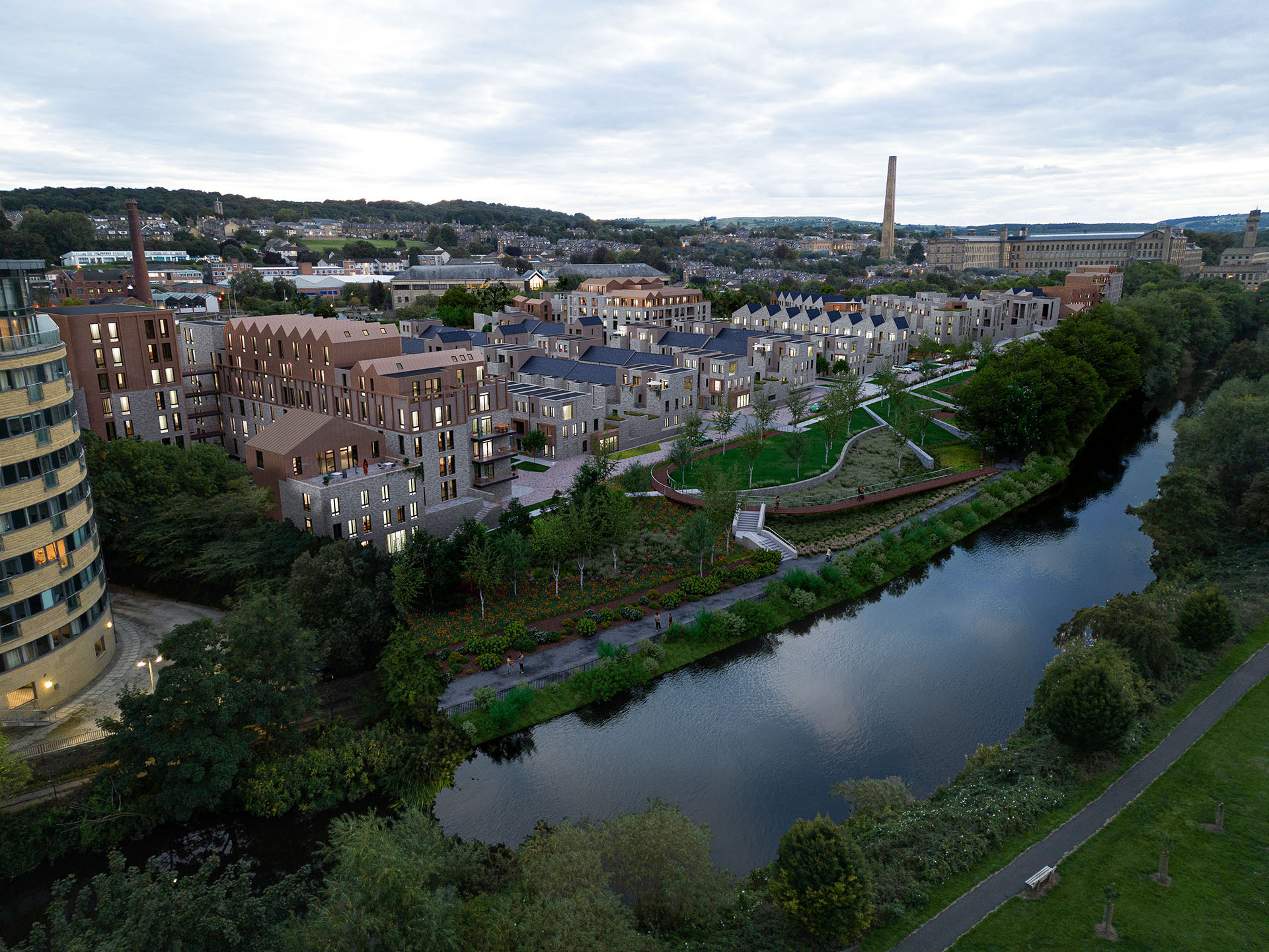
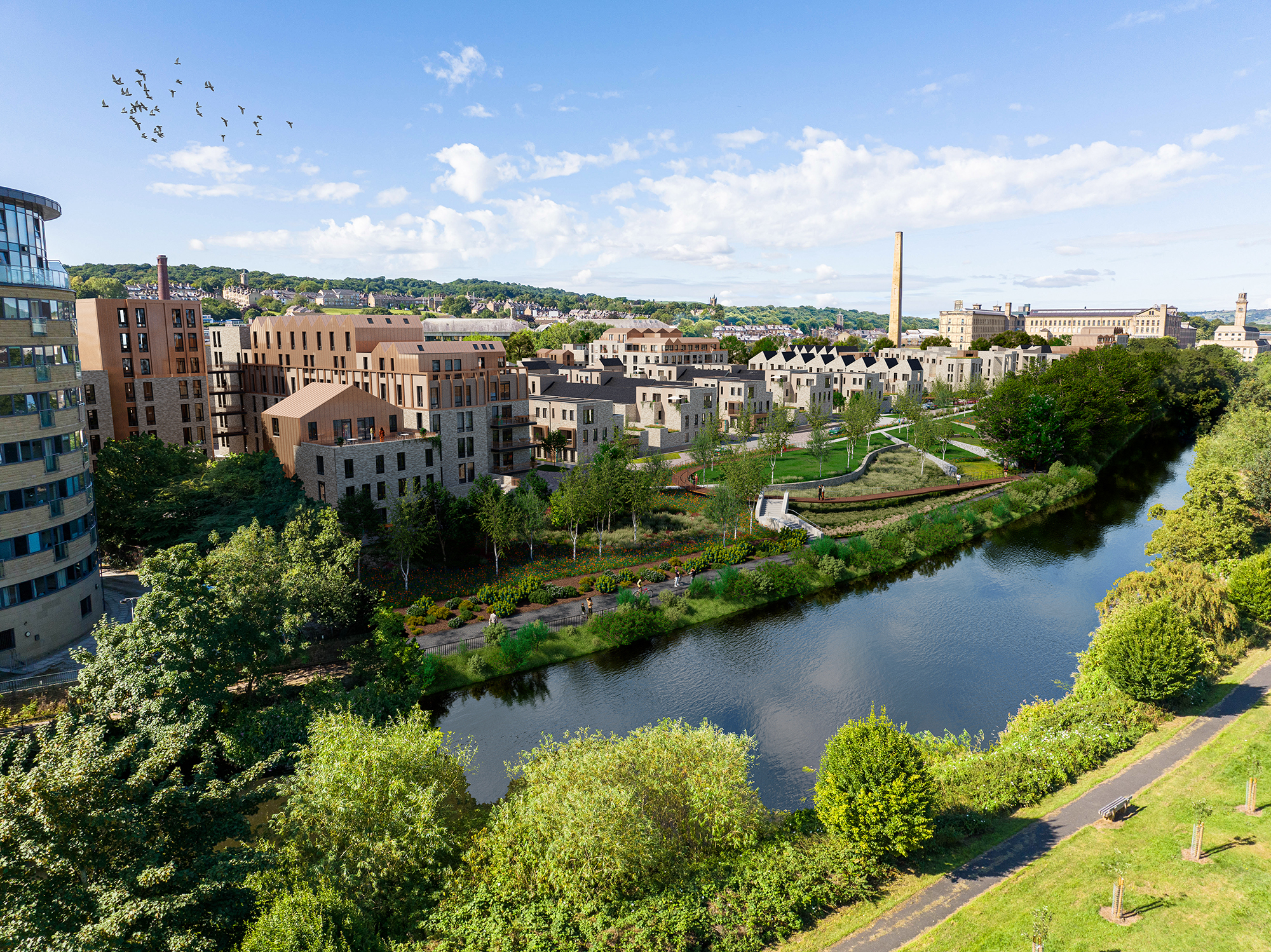
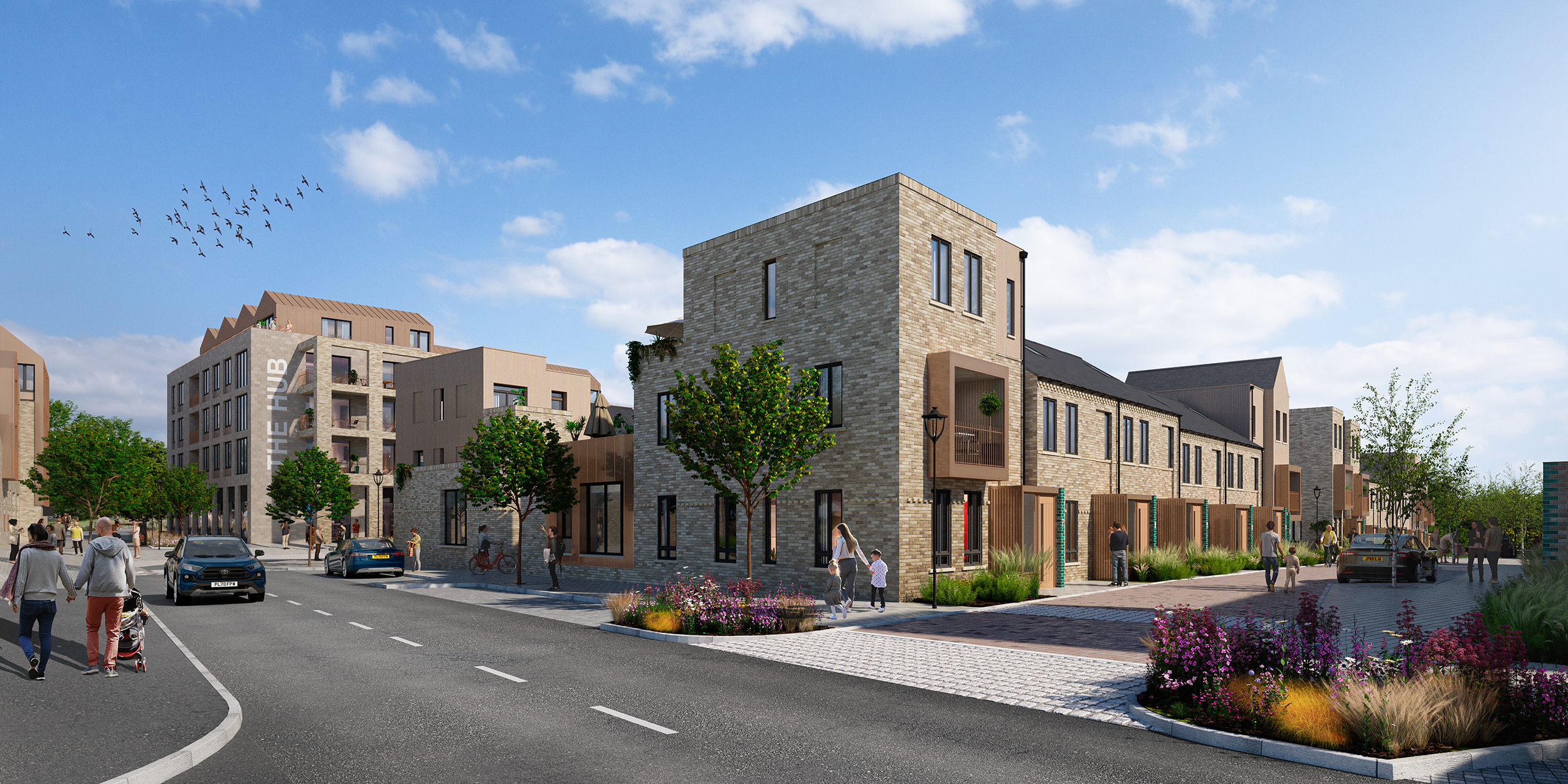
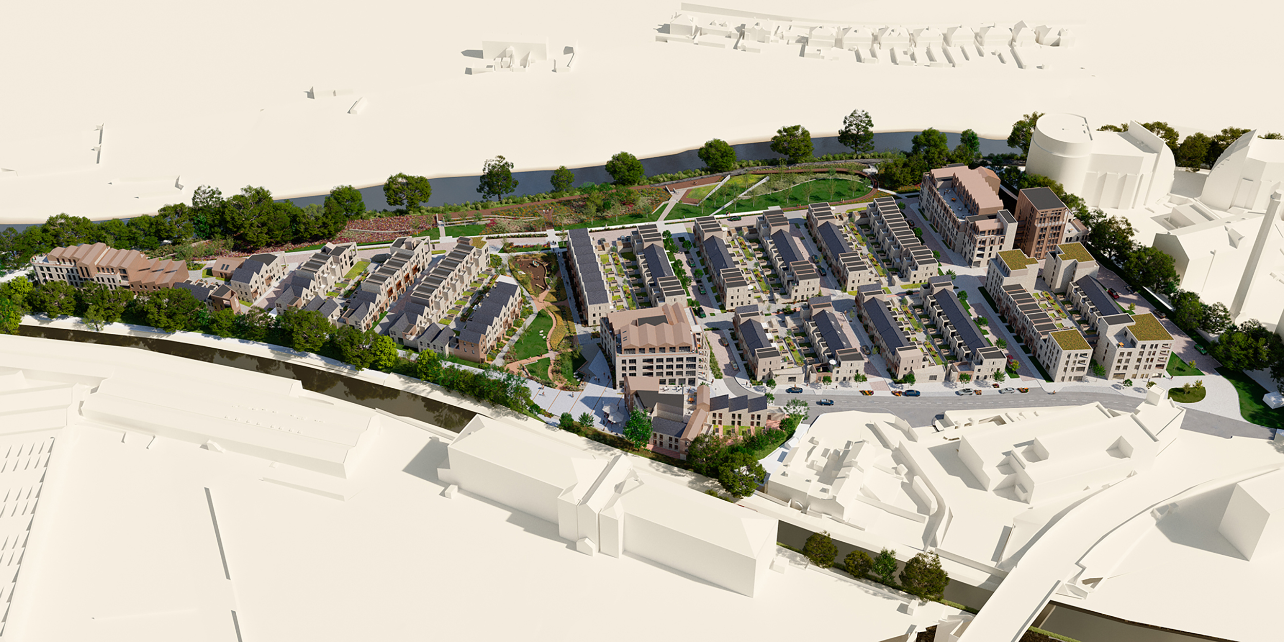
A new vison for the 4.5HA HMRC Inland Revenue site on the edge of the world renowned UNESCO Saltaire World Heritage site has been submitted for planning. The site previously contained an imposing dated government building in visual discordance with the surrounding heritage, set within extensive tarmac parking areas and occupying underutilized land between the River Aire and the Leeds Liverpool Canal. The vison is to regenerate the site into a new green community development comprising housing, offices, commercial units and co working space in thoughtful synergy with its urban and natural context, within extensive green infrastructure to restore and enhance native habitats, improve access along them, improve water quality and expand recreational opportunities through greenways and public destinations . The site offers huge potential to locate a thoughtful and sympathetic development within a wonderful natural setting whilst regenerating the surrounding environment.
Natural Dimensions was part of a multidisciplinary team of experts and local partners providing input into a vision over 12 months of stakeholder consultation and design development for the equitable re-diversification of this important gateway space to create a contemporary urban extension as a modern interpretation of the neighboring UNESCO WHS Saltaire heritage assets in an openly accessible, well connected and environmentally responsible setting. Natural Dimensions also produced a comprehensive townscape and landscape impact assessment to support the design application which incorporated extensive character analysis.
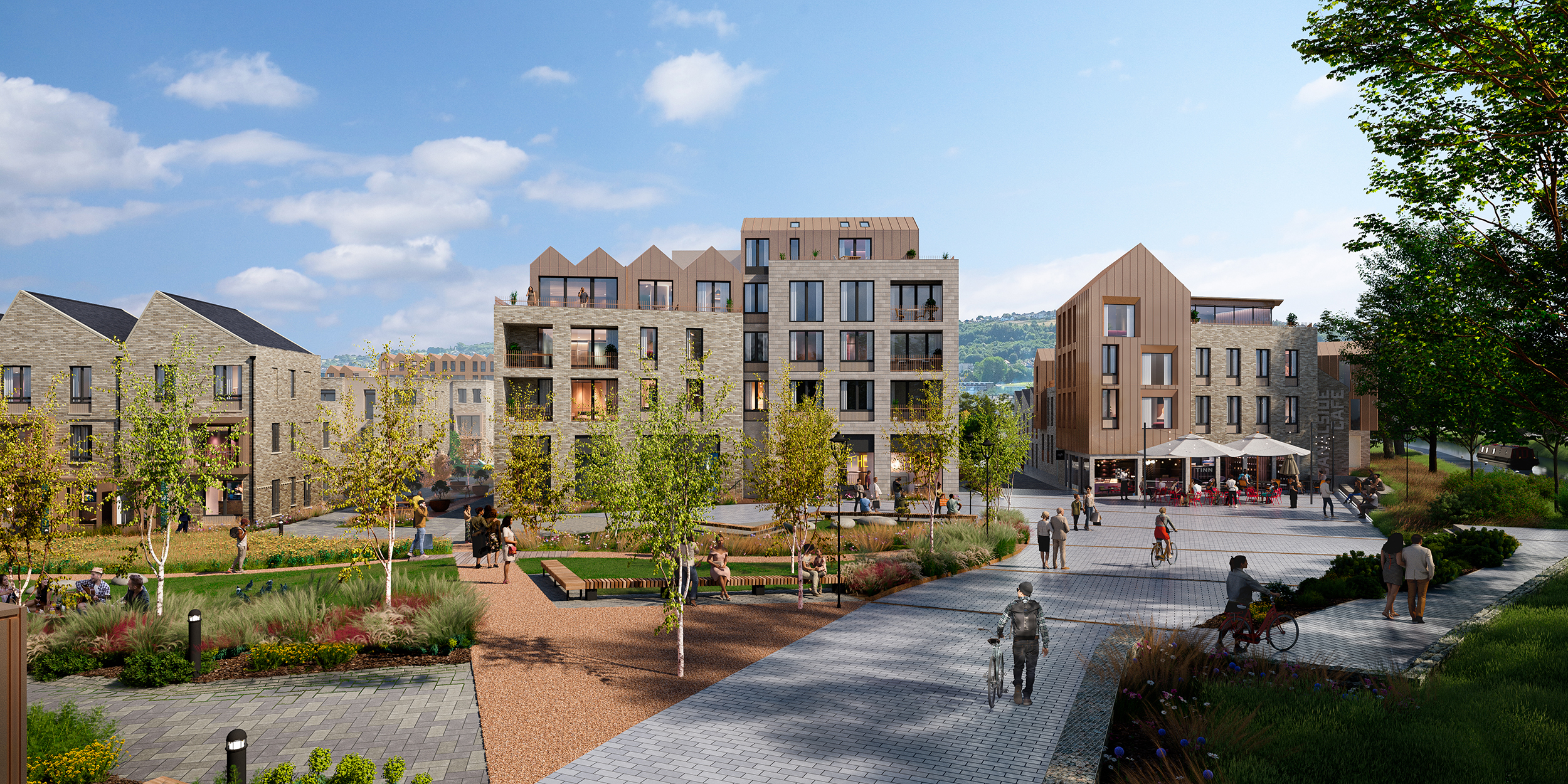
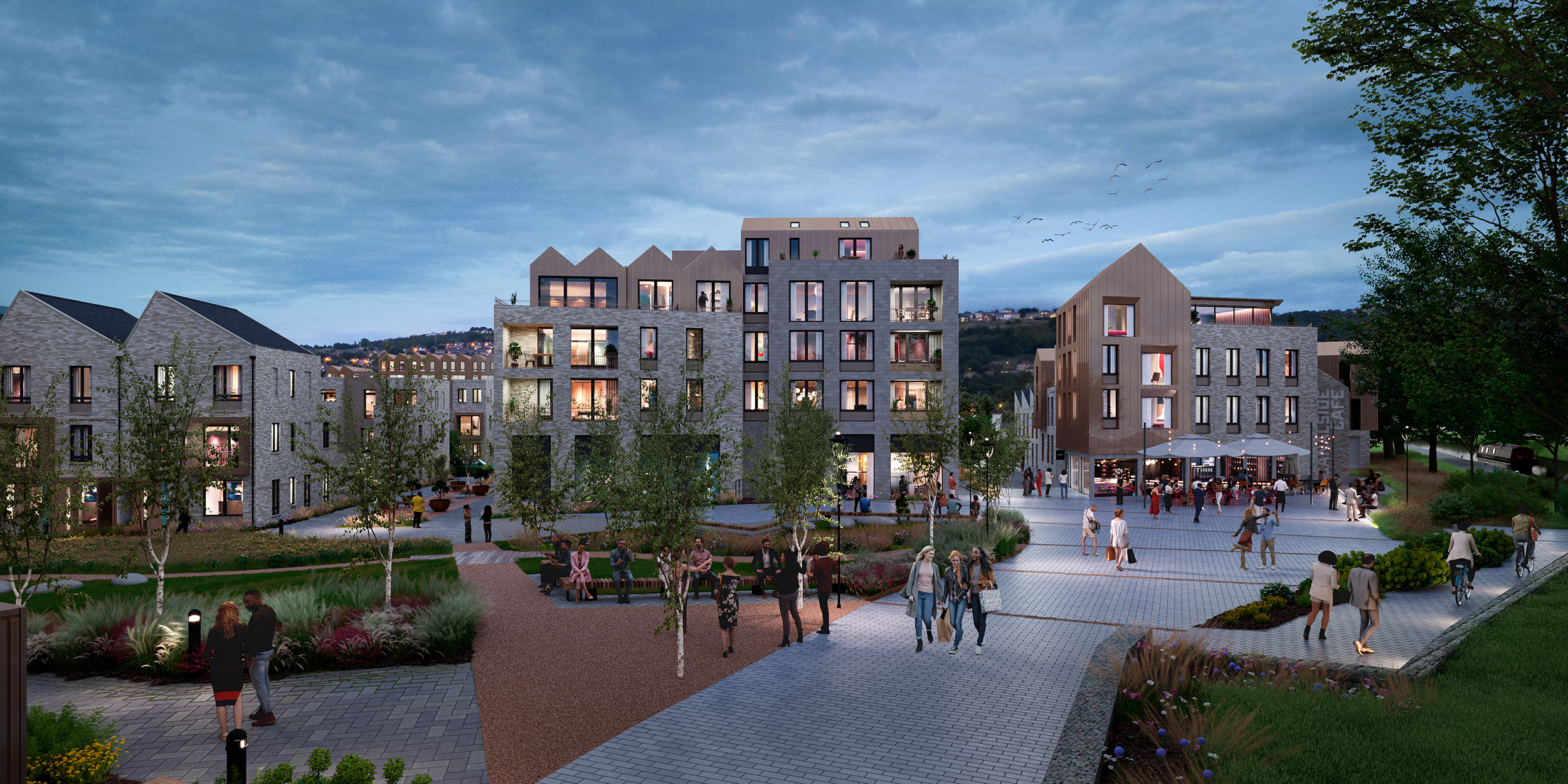
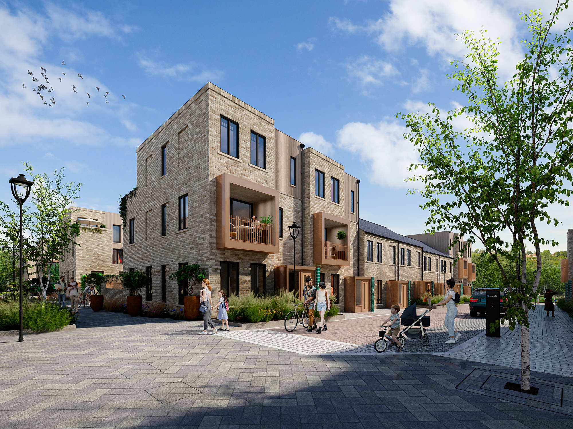
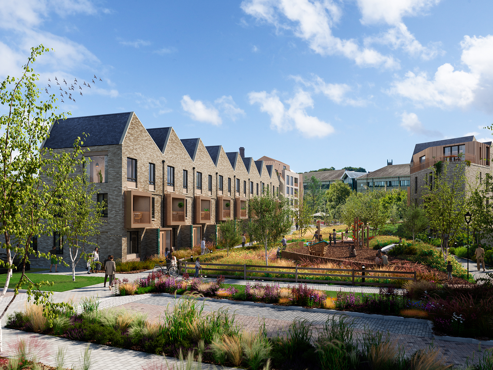
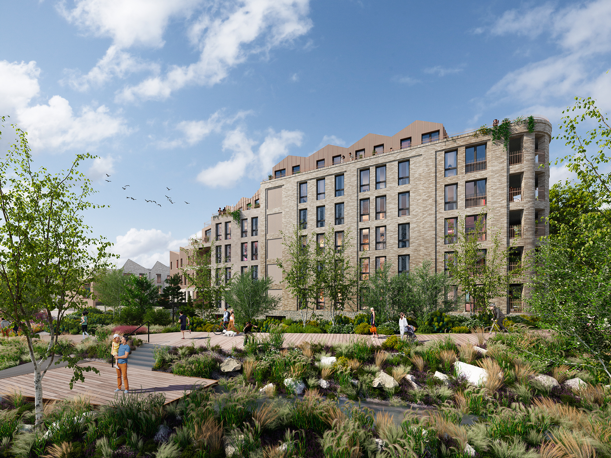
The architecture and landscape architecture is a modern interpretation of the existing heritage vernacular with design commensurate with the status of its world renowned surroundings. Designs incorporate the latest climate adaptive technologies, strong green infrastructure and high quality materials. The scheme enhances natural margins, and provides green and blue links between water courses, along pedestrian priority streets and through greenspaces. Central to these links are two new main green spaces and a large canal side square providing important social space for the new and existing community.
Firstly, a central park is at the heart of the development and extends green pedestrian and cycle links out into the rest of the scheme. It provides a backdrop to the proposed canal side square and adjacent development, provides links between the canal and the river through the park and acts as a community event space whilst incorporating significant SUDS technologies .
The second significant new green space is the riverside park. This proposes a significant opening up of the previously hemmed in, uninviting and poorly surfaced riverside pathway into a much wider linear park with multimodal access to re-establish the river as an important cultural and community resource and destination giving accessibility to all and linking more effectively into the existing community assets .The 2 HA linear riverside park is designed to prevent the impacts of flood events and provides a richer more diverse sequence of habitats including wetlands, grasslands, low scrub and woodland around areas of public access, amenity and habitat engagement.